-
itk-WatershedImageFilter
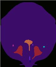
Watershed segmentation assigns the pixels of an image file to different regions, depending on the gradient values at each pixel. The image is treated as a height function. Local minima in the gradient of the height are treated as watershed lines, or the locations of water basins if water flowed over the surface defined by the height function. The technique is usually preceded by a preliminary filter to smooth out noise and identify edges. The input parameters set the minimum threshold value for the watershed and the watershed level.
Usage: itk-WatershedImageFilter inputImageFile outputImageFile dimension lowerThreshold level
Below is an example of an image that has been filtered using the itk-GradientMagnitudeRecursiveGaussianImageFilter
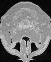
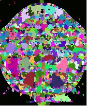
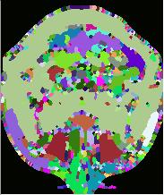
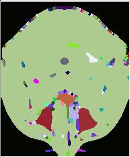
and then the itk-WatershedImageFilter. A section of the original
image file is shown along with sections from filtered files using watershed levels set at 0.1,0.15,0.25, and 0.5,
and lowerThreshold value of 0.001: